
Dispatches from the Cryosphere
For the majority of us in the Chesapeake Bay Watershed (with the exception of New Yorkers and those from northeastern PA), we will likely not encounter moraines, fjords, drumlins, eskers, or kettles on our watershed ramblings. These are just a few of the landscapes left behind by the massive Laurentide Ice Sheet that dredged its way across Canada and the northern tier of the U,S, 100,000 to 11,000 years ago.
However, there are still places on this remarkable planet that are covered with ice – the Cryosphere.
The Cryosphere is the part of Earth that is frozen. Think ice sheets, glaciers, permafrost. The “cry” in Cryosphere is derived from the Greek krios, meaning cold, but I can’t help think of the double meaning here as these fragile systems melt away.
My two kids spent this past summer in Alaska working in the Wrangell-St. Elias National Park and Preserve. This gave me and Garnett the amazing opportunity to go walking in the Cryosphere, which includes the many glaciers that inhabit that region.
Our first glimpse was from the air in one of the small flightseeing planes operated by Wrangell Mountain Air (my kids’ employer). Before seeing the glaciers themselves, we viewed their downstream progeny — the multi-braided silty rivers – with names like Chitina, Nizina, and Kennicott — that flow out of the glaciers, carrying their loads of gravel, boulders, silt, and sand.
From the air, the glaciers themselves look like glowing avenues of ice and snow. The surfaces can be striped, stippled, rippled, or fractured into alligator skin patterns – variants based on the slope and mass of the glaciers and the nature of their descent down the carved-out valleys. Peering out of the airplane window, I wondered what it would be like to be at ground level, walking on the glacier.
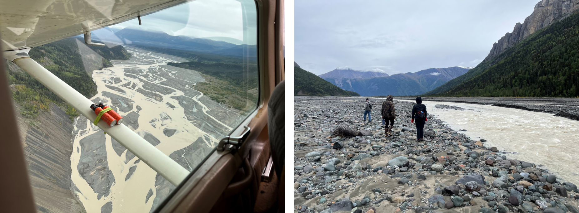
The rivers that emerge from the glaciers are braided and silty, bearing all the various particles washed out from the glacier. On the ground, these are expansive landscapes of rock, silt, and water. Photos: D. Hirschman.
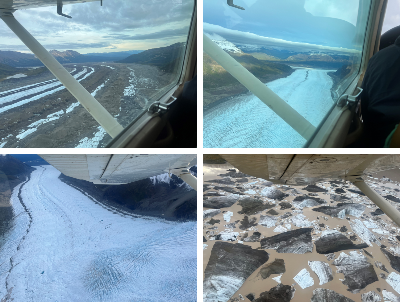
View of various glacial features from the air. Top left: the darker colored racing stripes are medial moraines. Top right & bottom left: various ripples and textures of the Wrangell Mountain glaciers. Bottom right: Glacial lake with floating icebergs at the toe of the Nizina Glacier. Many thanks to Oren Hirschman & Wrangell Mountaiin Air for the flightseeing tour! Photos: D. Hirschman.
A few days later, we had our opportunity, as the Root Glacier is a short hike from the historic copper mining town of Kennicott, now managed by the National Park Service. The trail traversed along the lateral moraine, marking the previous boundary of the glacier. The current glacial surface was far below.
The initial glimpse of the glacier was not of white snow or the characteristic bluish glowing ice. Rather it was a greyish or brownish choppy landscape consisting of every conceivable particle size, ranging from the tiny sediments that lend their grey color to the downstream rivers to sand, gravel, and giant boulders. Unlike flowing rivers, glaciers have no interest in sorting material by particle size. Their muscular descent down the valley will carve, chop, cleave, and carry anything in its path.
As it turns out, this layer of darker sediment lies on top of the underlying glacial ice like a blanket, and this plays an important role in the how fast the ice is melting due to climatic conditions. If the blanket is thick enough, it serves to insulate the ice, slowing the rate of melting. However, as the blanket thins, it’s darker surface color absorbs more solar radiation, transmitting it to the underlying ice and expediting the melting. Melting glaciers have profound global affects on sea levels and salinity levels in the oceans, among other impacts.
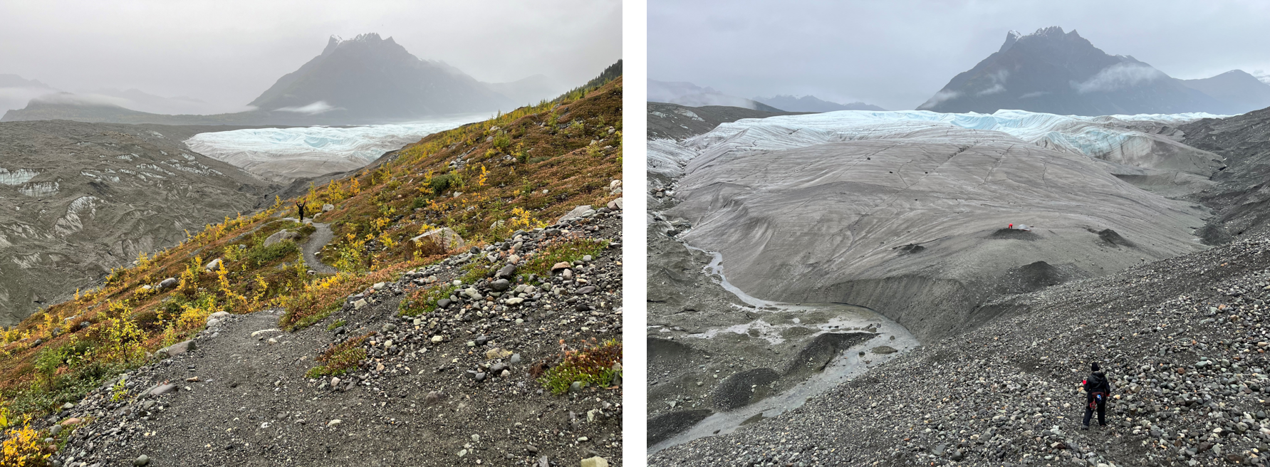
Hiking down the lateral moraine (previous edge) of the Root Glacier near Kennicott. We approached the transition from the debris-covered glacial surface to the exposed ice. The overlying debris layer covers the ice like a blanket, and, if thick enough, slows the melting process. Meltwater streams emerge from below the glacier. Photos: D. Hirschman.
All of this we learned from a team of scientists from Alaska and China that happened to be conducting field work during our visit, a fortuitous circumstance that helped us understand what we were experiencing. As it turns out, this phenomenon of a blanket of rock and debris covering glacial ice occurs on Earth (including Alaska and China) as well as Mars, and the researchers are studying both planets (although field work on Mars is harder to manage).
Eventually, as we ascended the valley, the blanket of sediment gave way to exposed ice. We drew closer and the glacier appeared as something mammoth and sentient. . .alive, intelligent, willful. . .in ways that are difficult to explain and much different than the bird’s eye view from the air. We strapped on the mini-spikes to our hiking boots and headed onto the shoulder of this beautiful beast. The sheer scale of the place was astounding.
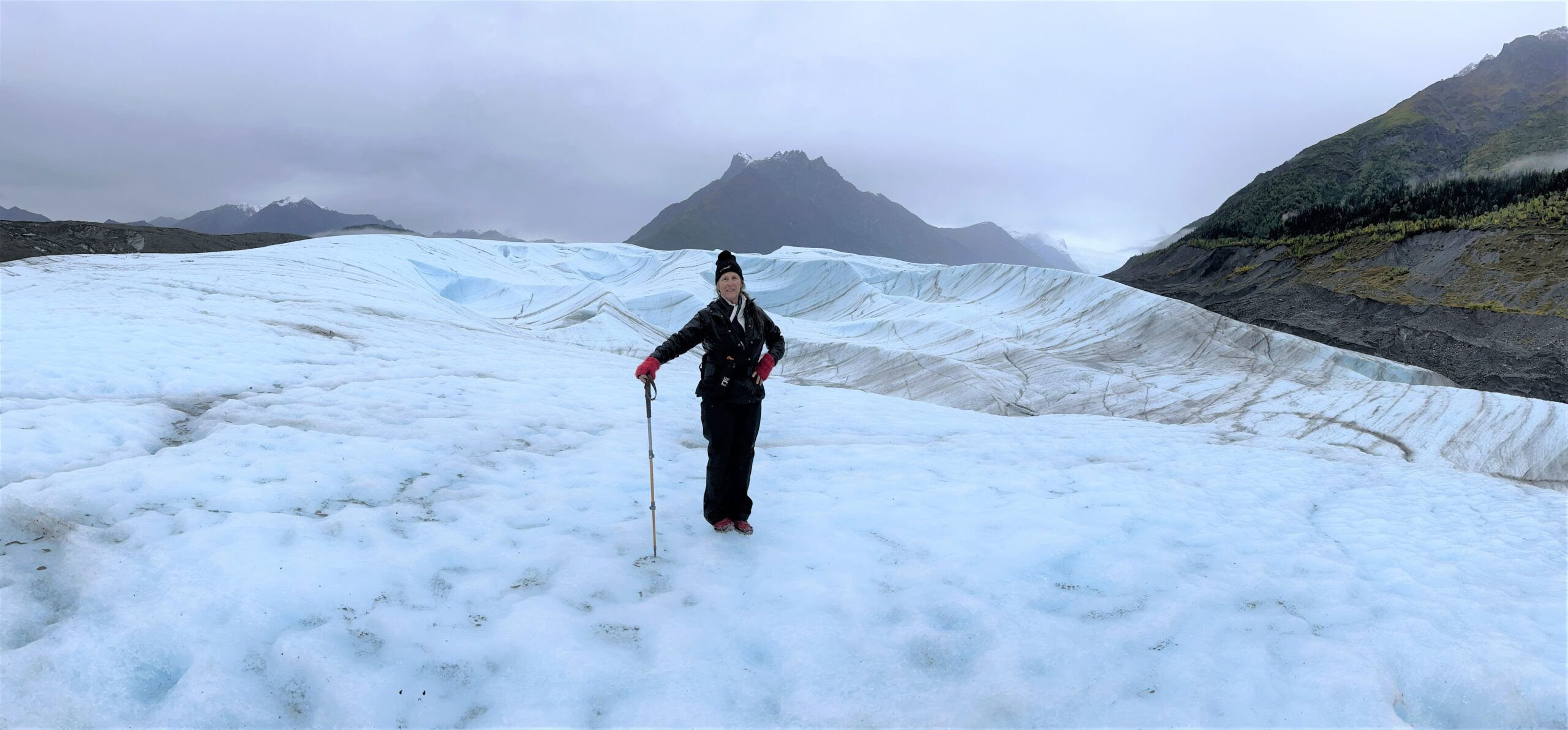
Garnett taking in the experience of walking on the Root Glacier. Photo: D. Hirschman.
This time around, our trip onto the ice was short, but we hope to return in coming years. For, as it turns out, walking in the Cryosphere bestows on one a great honor, privilege, and responsibility. The take-home — we are absolutely crazy to be letting this landscape melt away.
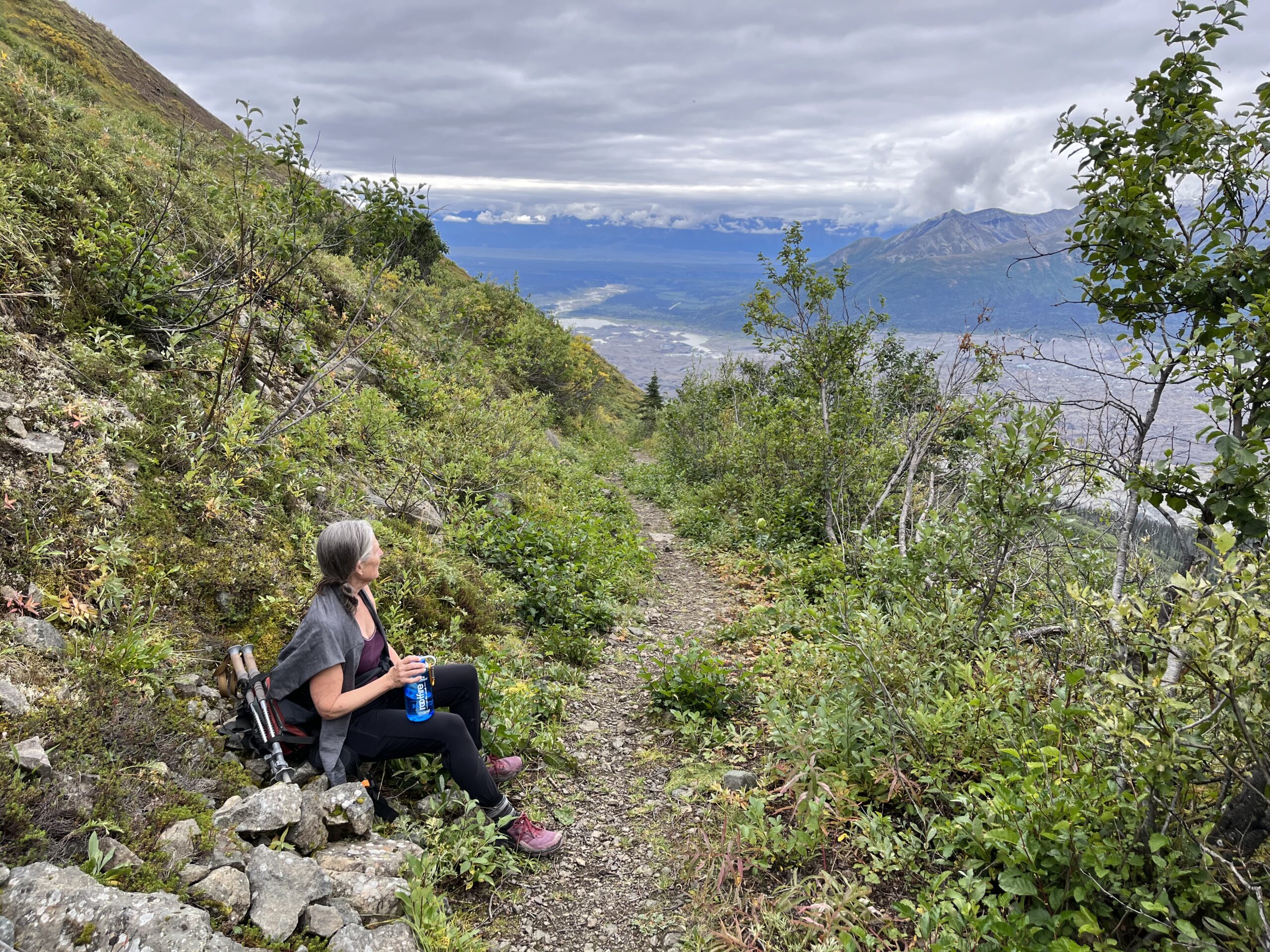
Hiking up the Jumbo Mine Trail, we could see the debris-covered Root Glacier below, still in the process of carving out the valley — truly a living landscape. Photo: D. Hirschman.
David J. Hirschman, dave@hirschmanwater.com
Many thinks to Eric Petersen from the University of Alaska Fairbanks and his team of researchers from Alaska and China for being generous with their time and information from an inquiring tourist. Part of the team’s work is studying the role of ice cliffs in glacial melting. The cliffs are formed by meltwater glacial streams that cut through the blanket of debris that is helping to insulate the glaciers. Below are a couple of videos about their research, produced, as it turns out, by Nicole Trenholm from University of Maryland Baltimore County (UMCES). So, through Nicole’s work, the glaciers have in a way come to the Chesapeake Bay Watershed.